The Total Solar Eclipse of August 12, 2026, as NASA Saw It
- Totality crossed northern Russia, eastern Greenland, western Iceland (about 17:45 UTC) and northern Spain just before sunset.[2]
- In León, Spain, totality began at 8:28 p.m. local time and lasted about two minutes, and the Sun set minutes after the partial eclipse ended.[1]
- The next total solar eclipse is on August 2, 2027, crossing southern Spain, North Africa, Saudi Arabia and Yemen.[1]
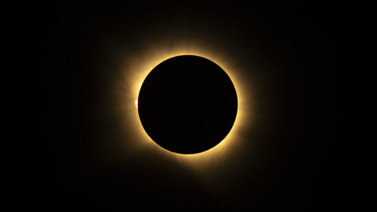
On August 12, 2026, a total solar eclipse darkened skies over Greenland, Iceland and Spain.[3] As the Moon covered the Sun, it briefly revealed the Sun's wispy outer atmosphere, the corona, to people in the path of totality who had clear skies.[3]
The path of the shadow
NASA's Scientific Visualization Studio says the path of totality began in far northern Siberia, near the North Pole, and ran south through the Arctic and North Atlantic oceans, over Iceland and Spain.[4] The shadow first crossed the Arctic Circle from northern Russia and then tracked along the eastern side of Greenland.[2] At about 5:45 p.m. local time in Iceland (17:45 Universal Time), the country's western fringes, including the Snæfellsnes peninsula, began to experience totality, and the greatest eclipse occurred near that sparsely populated peninsula.[2] The shadow then crossed the North Atlantic and reached northern Spain shortly before sunset.[2]
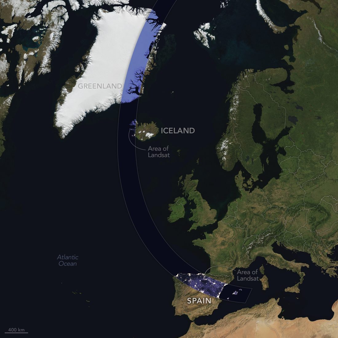
The last total eclipse before this one was on April 8, 2024, when totality crossed North America.[2] In 2026, NASA noted, the viewing locations were far more limited, with only a handful of land areas in the Northern Hemisphere inside the path.[2] The rest of Europe, parts of Africa, Canada and the northern and northeastern United States saw a partial eclipse.[2] Satellite cloud records suggested that viewers in Spain had a better chance of a clear sky than viewers in Iceland.[2]
Totality in a field of sunflowers
NASA photographer Bill Ingalls shot the eclipse from San Millán de los Caballeros, a town about 40 kilometers (25 miles) south of León in northwestern Spain.[1] His composite photograph, made from images taken before, during and after totality, shows the whole eclipse over a field of sunflowers.[1] In León, the partial eclipse began at 7:32 p.m. and ended at 9:22 p.m. local time, just minutes before the Sun set.[1] Totality started at 8:28 p.m. and lasted about two minutes.[1]
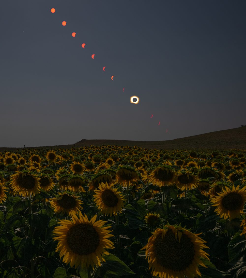
In the photograph taken during totality (at the top of this page), a glowing loop of plasma called a prominence extends into the corona on the left.[1] NASA explains that plasma, a super-hot gas made mostly of ionized hydrogen and helium, flows along the Sun's twisted magnetic field, and that prominences can be many times taller than Earth is wide.[1]
Chasing the corona at 50,000 feet
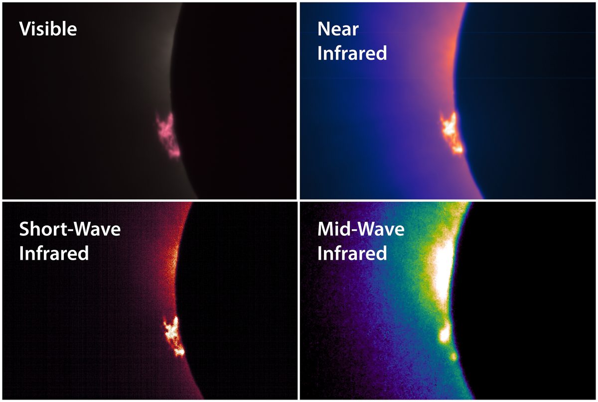
NASA pilots flew a WB-57F research jet at about 50,000 feet, off the coast of Iceland, passing through the eclipse's shadow to lengthen their time in totality.[3] The aircraft carried cameras that recorded the corona and prominences in several wavelengths of visible and infrared light, and a team led by the Southwest Research Institute in Boulder, Colorado, will analyze the images to learn more about the Sun's outer atmosphere.[3]
Balloons, clouds and a space station
Student teams in the NASA-funded Nationwide Eclipse Ballooning Project launched scientific balloons in both Iceland and Spain, carrying instruments to image the eclipse shadow and to study its effects on the atmosphere.[3] Clouds hid the eclipse from the ground in Iceland, but NASA says the weather did not stop the balloon instruments from measuring how the brief loss of light and heat affected the lower atmosphere.[3]
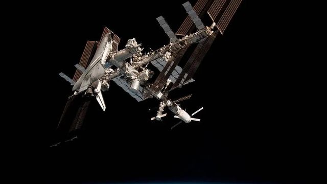
Elsewhere, NASA photographer Joel Kowsky caught the International Space Station, with a crew of seven aboard, crossing the partially eclipsed Sun near Hodgdon, Maine, at roughly five miles per second.[3] Astronaut Jessica Meir photographed the partial eclipse from the station itself, 262 miles above southern Quebec, where the Moon covered about 18% of the Sun at the peak.[3] Our guide to spotting the ISS explains how to see the station pass overhead.
Seen from space, and a test of a prediction
The European Space Agency released a video of the eclipse made from images by the Meteosat Third Generation Imager satellite, which sits about 36,000 kilometers above Earth and watches Europe and northern Africa.[5] It shows the Moon's shadow sweeping over Greenland and Iceland and then over parts of Portugal and Spain.[5]
Before the eclipse, scientists at Predictive Science Inc. used observations of the Sun from NASA spacecraft and ground-based telescopes to predict what the corona would look like.[3] NASA published that prediction beside a composite image of the corona made near León by the DEB Initiative team, so the two can be compared.[3]
What comes next
NASA says the next total solar eclipse will occur on August 2, 2027, with the path of totality crossing southern Spain, North Africa, Saudi Arabia and Yemen.[1]
This article relies on NASA's own reporting. Times and distances are as published by NASA. Photographs credited to NASA are used under the NASA Images and Media Usage Guidelines; NASA does not endorse this site.[6]
Sources6tap to view
- NASA Earth Observatory (Lindsey Doermann). A Sunflower's View of Totality. August 14, 2026. Accessed October 23, 2026.
- NASA Earth Observatory (Lindsey Doermann). Stops Along the Path of Totality. August 12, 2026. Accessed October 23, 2026.
- NASA (Vanessa Thomas). NASA Shares Views of August Solar Eclipse from Ground, Air, Space. August 21, 2026. Accessed October 23, 2026.
- NASA Scientific Visualization Studio (Ernie Wright). Map of the August 12, 2026, Total Solar Eclipse. May 22, 2026. Accessed October 23, 2026.
- BBC Sky at Night Magazine (Iain Todd). The solar eclipse from space: satellite captures the Moon's shadow passing over Earth during the August 2026 eclipse. August 14, 2026. Accessed October 23, 2026.
- NASA. NASA Images and Media Usage Guidelines. Accessed October 23, 2026.